-
The other Royal visit to train 014 and SkyTrain’s influence abroad
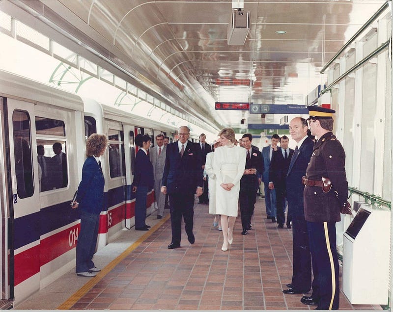
Princess Diana walking along the platform of Patterson Station in 1986 (City of Vancouver Archives)
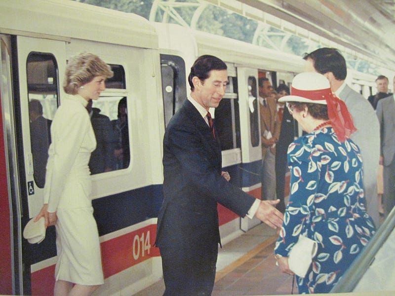
Prince Charles (now King Charles III) and Princess Diana greeting two people (Vancouver Province)
In 1986, during Expo ’86, King Charles III (then Prince) and his then wife, Princess Diana paid a visit to Patterson Station in Burnaby to see the new rapid transit system. They boarded car 014, dubbed the “Spirit of Canada”, and made history as the first visiting monarch to use the transit system.
However, this visit overshadows another royal visit and one that had substantial ramifications for the country the monarch heralded from.
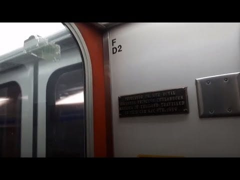
Plaque as seen on train 014
On May 8th, 1989, Thailand’s Princess Chulabhorn paid a visit to Vancouver and rode on the very same car the Prince and Princess of Wales rode three years prior. Ten years later, Thailand’s capital city, Bangkok would open its BTS Skytrain.
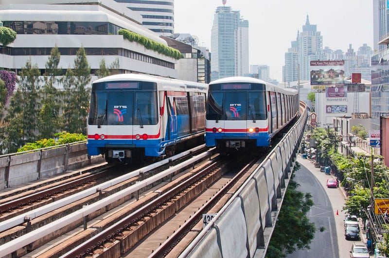
BTS Skytrain vehicles passing each other (author unknown)
However, unlike the Vancouver SkyTrain (note the upper case ‘T’ in our name), Bangkok’s system did not use trains from Bombardier and instead its initial set were from Siemens. The reason for the name was that the original system proposal was the Lavalin Skytrain, as SNC Lavalin itself was responsible for the construction of Vancouver’s system. This project was cancelled in 1992 officially due to financial reasons, but it was suggested politics played a role in its demise.
For whatever reason, despite SNC Lavalin’s lack of involvement in the succeeding project, the name “Skytrain” stuck and in 1999, the Bangkok Mass Transit System officially opened and named as “BTS Skytrain”. Perhaps the Princess just liked the name? Who knows.
This was originally posted to cohost.org/VancouverTransit.
-
Sunsetting a moderation bot
Years ago, I wrote in-depth about Twitch being a complete trash fire. As a response to it, I made a bot which I shared with about 40 different streamers that addressed Twitch’s shortcomings.
For about a year and a half, this bot ran largely uninterrupted and had all sorts of features such as predictive bans, exemptions, algorithmic bans, and so forth. It was far more advanced than whatever Twitch had out there and I believe it probably prevented a few hate raids against marginalised streamers.
In February, Twitch removed the ability to perform bans via its chat interface and instead shifted everything to requiring a user access token in conjunction with its HTTP API.
On the surface, this is fine in the grand scheme of things, but it required me to completely rejig the entire authentication model from just simply using a
/modcommand on the bot and then me joining the channel to asking for everyone to sign in and pass me a token. This is a piss-poor design because it would be just easier to assign the permissions via legacy means, but nope, you have to re-authenticate that bot.I might be overthinking or misunderstanding this, but the bot also has become more onerous to update and is also costing me CA$40/month of which I largely pay out of pocket–not complaining, but it is a personal expense that would have not occurred if Twitch had made good tools years ago. Combine with increasing living expenses, I have decided that it’s not fun to pay for this anymore.
In any event, because of the cost and Twitch finally has tooling that makes it easier to deal with bullshit after much, much yelling in their direction from all sorts of groups, I feel it is time to officially state that I have sunsetted the bot. I hope that it did benefit those who needed it most and I am always willing to provide a hand should anything come up in the future. ❤️
In case you’re wondering: all data is being deleted from the database and backups are going with!
-
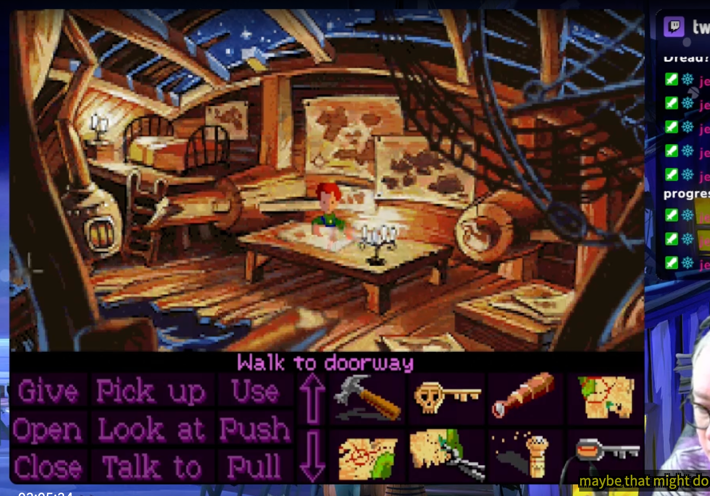
I managed to softlock Monkey Island 2: LeChuck's Revenge
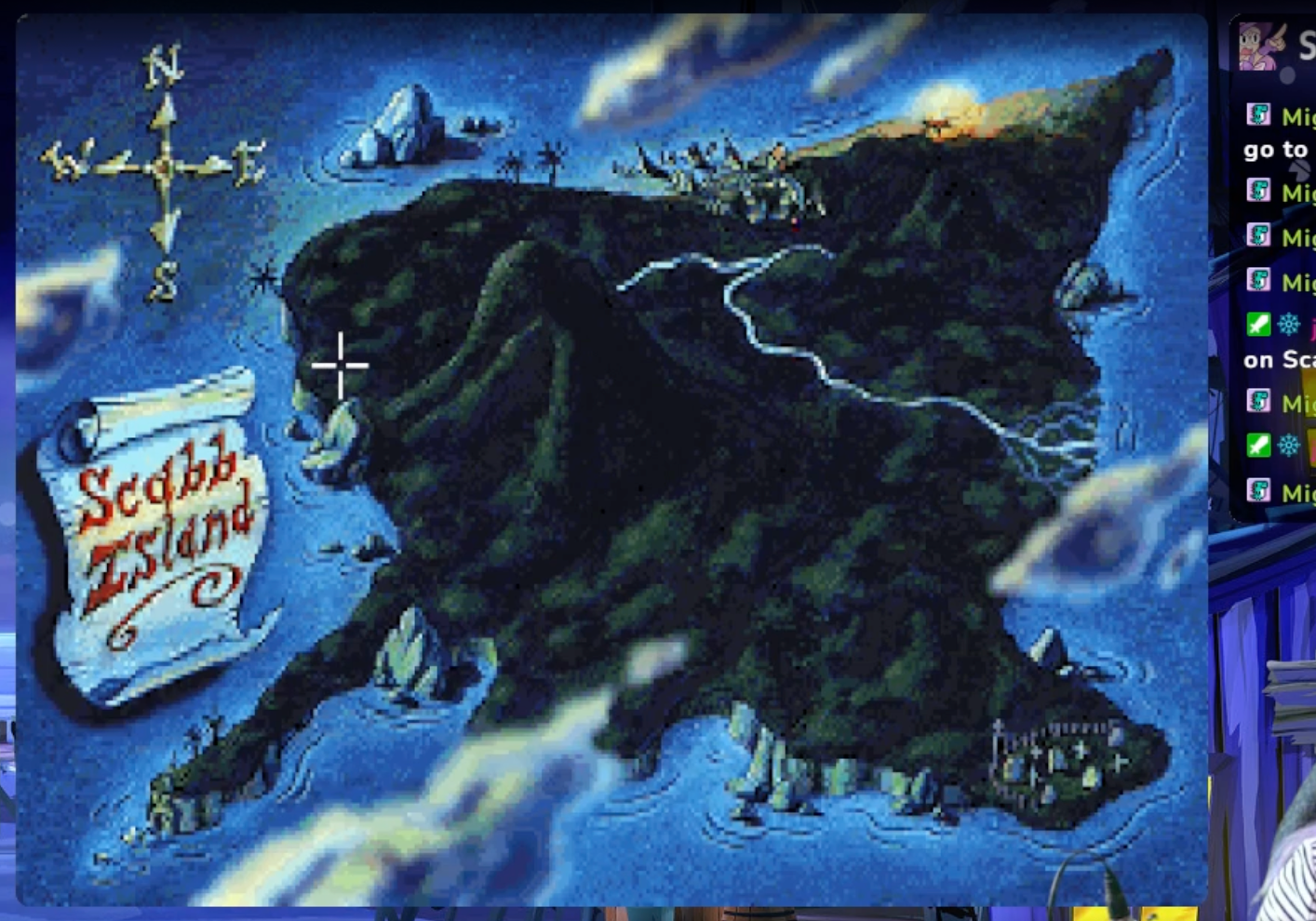
It turns out that in the Ultimate Talkie Edition of Monkey Island 2: LeChuck’s Revenge, touching the model lighthouse in Phatt Island but not retrieving its lens creates a softlock condition. When returning to Scabb Island, Dredd leaves to go “do errands” and consequently makes you stuck without the ability to get the map reassembled. The cartographer in Scabb needs that lens but you have no boat to go back!
This bug does not exist in the non-Talkie versions as far as I can tell. I did some searching in various places and it appears that I am not the first person to run across it.
-
Ghosts: Connaught Hill
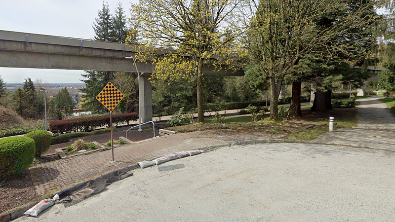
Approximate location of the former station, Connaught Hill (Google Street View)
When riding down the Expo Line from Edmonds to 22nd Street, one may notice that it is a rather lengthy ride. At nearly 2 KM, it’s nowhere near the longest distance between stations, but when it was the interurban Central Park Line, there was a station in-between the two.
The BC Electric Railway (BCER) had a station around what is now 9th Avenue in Burnaby or simply situated south of a SkyTrain maintenance facility. Connaught Hill, named after after the western province of Ireland named Connaught, was a small station serving the now-residential area straddling the Burnaby and New Westminster border.
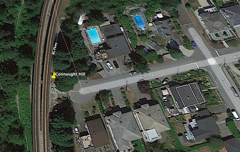
Station location in New Westminster (Google)
Back then, it was a large gravel pit. The hole created conveniently ended up becoming the SkyTrain maintenance facility we have today.
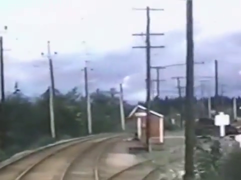
Connaught Hill as it appeared in the 1950s (TransLink / BC Transit)
Today, there sits no station but you can visit its old location when travelling along the BC Parkway.
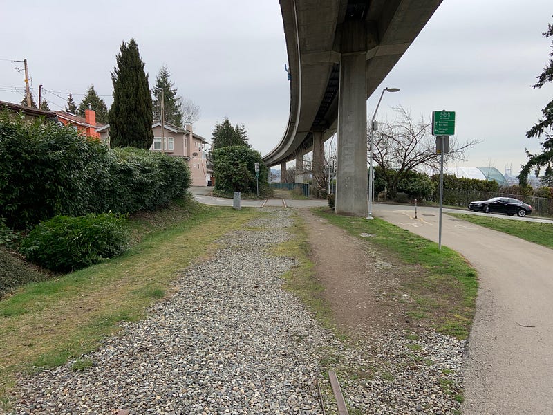
Stopped to take a photo as I cycled on by. You can see the remnants of the old tracks left behind.
-
Thoughts on each MBTA rapid transit service
I just came back from Boston and ended up riding each line that the MBTA provides in the Boston area except for commuter rail and some heritage railway I didn’t need to use. Because of how weird the entire network is itself, I have a thought on each line in a sort of roasting-like manner.
The whole network is weird to me because no single line runs the same type of vehicle as another. This is a bit baffling coming from a city where there are three lines and two of them use the same train types. That and the headways between trains just makes it so awkward.
At least this visit to Boston unlike the last one had all of the lines as functioning although on the weekend one line was running with a shuttle bus between two stations.
Red Line
Braintree and Alewife are termini? These names are just wild. This is probably the most normal of the lines I rode
Blue Line
Wonderland is the name of a terminus? I have never been in a subway where not only do the platforms curve upward but also to a side. That is some impressive engineering.
Orange Line
Nice to know that trains can catch fire and not manage to kill anyone. Why does this line run so slowly again?
Green Line
Good lord. This line is weird. Level-crossings for pedestrians isn’t so weird, but it is extremely weird when they’re inside of the subway itself. Also, is this a subway or a tram? The use of low-floor trains kind of remind of Brussels’ tram network, but these cars are nowhere near as elegant.